 The new Connecticut 3D Lidar Viewer marks the first time that 3D elevation points from remotely-sensed Lidar are available in an interactive format over the web. Lidar is a remote sensing technique to map elevation using a laser sensor on an airplane. The result is millions and millions of points that each have a measured elevation. Lidar points have been historically difficult to work with due to sheer volume, complexity and large file sizes. The 3D Lidar Viewer is an easy to use and fast way to view a massive number of elevation points as well as make REAL measurements including area and height.
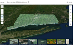
The Connecticut 3D Lidar Viewer is a proof of concept for publishing statewide colorized Lidar points in a 3D ArcGIS Online web scene. Many thanks to the Esri’s Living Atlas Team who used Esri’s ArcGIS Pro software and published the layers and viewer to ArcGIS Online. It is available on the CT ECO website which is a partnership between UConn CLEAR and CT DEEP.
The Connecticut 3D Lidar Viewer brings flat mapping layers to life.
The Viewer contains:
- Lidar points colored by underlying aerial imagery, called Colorized Lidar (statewide).
- Lidar points colored by their return intensity, called Class Code Modulated (statewide). It sound complicated, but looks cool. Chet likes it as art.
- Lidar points colored by elevation, called, well, Elevation. Higher elevations are red and lower are blue.
- Only the Lidar points classified as buildings and bridges, called, well, Building and Bridges. Removing all other points let’s us focus on roof and bridge lines and details.
- 3D Buildings and Trees which are not the points but the results of some data processing (for Middletown, CT area only). Here, the buildings have real roofs and walls and the trees have crowns. Click on any building to see information such as building height and rooftop type or any tree to see height and crown diameter.
- Other existing layers are also in the viewer for exploring and comparing. They are bare earth shaded relief, impervious surfaces, contours and aerial imagery.
To get started with the Viewer, click on the slides along the bottom. They are a tour through different locations and different map layers. Visit the Viewer Help page to learn how to move around the 3D scene, turn layers on and off and more.

The Bottom Line
Beyond it’s wicked cool capabilities, the 3D Lidar Viewer is another strong case for the importance of (1) creating good base GIS layers and (2) sharing them. Highly skilled developers like those at Esri have gravitated to Connecticut (virtually at least) to try out new technologies and tools because Connecticut has some amazing statewide map layers AND they are all free, available and easy to find (thank you CT ECO). Without these layers, this viewer would never have been possible.