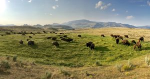
It’s summer. Family vacation time. I don’t know about you, but I’ve been waiting for this all year. We had planned to take the family west for two weeks in the mountains. Utah, Wyoming, Montana, and Idaho. Yellowstone and Grand Teton National Parks. Off the beaten path. Round up the kids, pack up the camping gear (and also…arrange flights, rent an RV, organize logistics, do we have the bug spray?), and let’s go!
The truth is, in the weeks leading up to the trip, work kept me BUSY (see here) and I slacked when it came to researching the fine details of the trip. I didn’t worry too much, we had made our critical Yellowstone campground reservations months before. We had a place to stay. We could figure the details out when we got there. But as it turns out, I (like many others) had forgotten one minor detail. These rugged places, some of the most beautiful land our country has to offer, is lacking only one thing…cell phone service. What sounds like a bonus feature of being in the mountains (and it was), also made my on-the-fly planning a little more challenging.
I’m sure I don’t have to tell you this, but one thing became pretty clear to me on this trip – we live in a world that relies heavily on the tiny computers we carry around in our pocket. Smartphone devices give us driving directions from point A to point B. They help us find our way to that secret hot spring, stunning vista, or backcountry waterfall. But, many of these maps and apps rely on the technology of the front country – cell service, to calculate driving directions or ask Siri where the closest ranger station is.
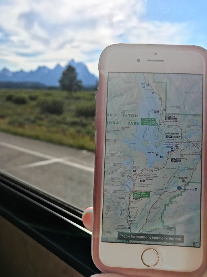
So, what’s an ill prepared camper to do? Enter Maplets. Maplets is an offline mapping app that allows users to download georeferenced maps (or georeferenced your own maps!) to a smartphone device and use them, along with the GPS in the device, to find your way around the world – even in the middle of nowhere. Once a user adds a map, it is made available to all Maplets users. There are 1000’s of georeferenced maps available in the app. So when I overheard someone mention that the National Park Service (NPS) Visitors Center had free wifi, I knew what to do. I scurried over, connected to wifi, downloaded the Maplets app on my iPhone ($2.99 – worth every penny) and did a search for user added maps. Several maps of Tetons and Yellowstone popped up, including the official NPS park map. A quick download to my device and suddenly, I was no longer lost in the woods. That familiar blue “current position” marker was placed perfectly on the park service map, indicating my location at the Visitor Center.
For the next two weeks, we used Maplets to find our way through the parks and wild places of the west.
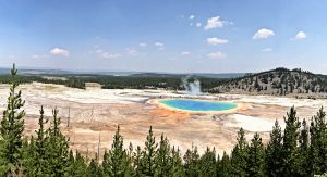
Highlights of the trip included hikes to glacial lakes in the Tetons, a visit to Old Faithful and Grand Prismatic Spring in Yellowstone, and sleeps in the rugged Sawtooth Mountains of Idaho. So, Maplets FTW (for the win). Be sure to check it out for your next visit to the backcountry! You’re guaranteed to be tagged as the “geo-geek” of the family (an honor, IMO (in my opinion)), but you might just save the day when you’re all looking for that hidden trailhead.
Save
Save