The NEMO program’s National Low Impact Development (LID) Map is an interactive resource for finding examples of LID like green roofs, pervious pavements, and bioretention areas. These approaches to stormwater management help prevent flooding and water pollution by encourage infiltration into the ground instead of runoff. First launched in 2008, the site now has 1,400 LID examples from 35 states.
 NEMO has just completed a new mobile version of the LID Atlas that is designed specifically for a smaller screen, but also adds some very exciting new features.
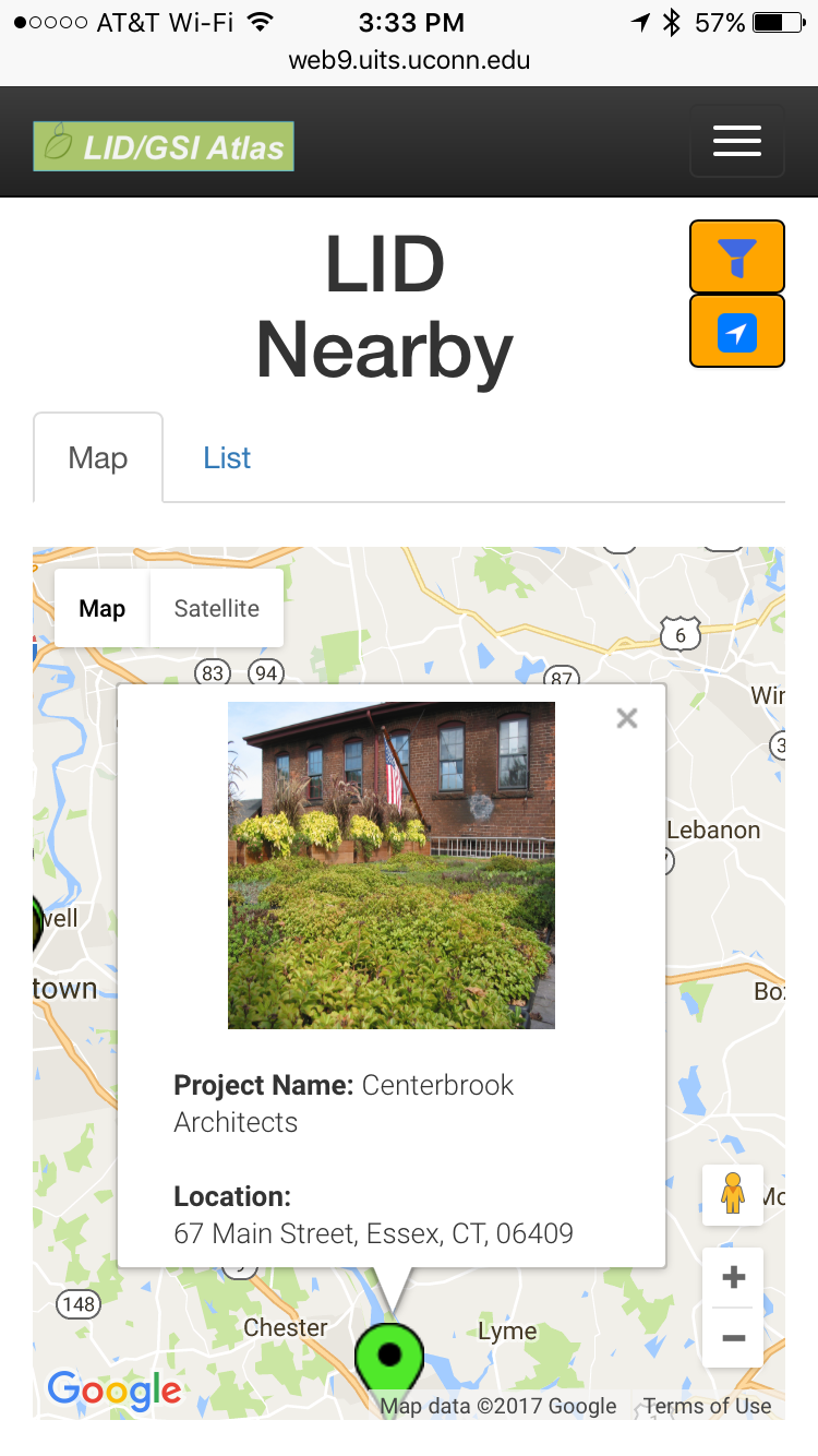
- LID Nearby: The mobile version of the Atlas automatically zooms to your current location and shows you examples of LID within a 10 mile radius of your current location (assuming there are any in the Atlas database). You can expand your search to a larger area, select specific types of practices, or specific types of land uses (e.g., residential, commercial, etc.).
- Quantify Impacts: When adding new examples to the Atlas you can now add the size of the practice and the size of the area it drains. The Atlas will calculate the amount of stormwater runoff (based on local rain fall amounts) diverted from the storm drain system by that installation.
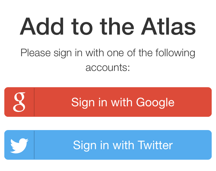
- Add to the Atlas: For the first time, anyone with a Google or Twitter login can add examples of LID to the Atlas. Simply click on the add tab and practice.
To explore the new mobile version simply go to http://lidmap.uconn.edu on your smartphone or tablet (operating system doesn’t matter). The Atlas automagically displays the new mobile version. (If you don’t have a mobile device yet but are curious what the new mobile version looks like, visit http://m.lidmap.uconn.edu from a web browser on your computer.)
Have fun exploring and adding new sites to the LID Atlas!