The Map and Geographic Information Center (MAGIC) located at the University of Connecticut’s Homer D. Babbidge Library in Storrs, CT offers a vast array of historical maps from around the world, but with a large focus on the Connecticut region of North America on their website http://magic.lib.uconn.edu/
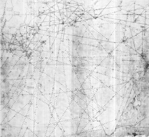
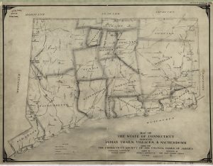
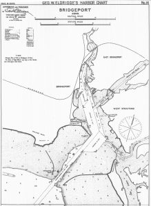
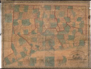
As you delve into this historical map database you soon realize the magnitude and varying topics of their collection. One map displays Native Americans trails, villages and territories throughout the state dated around 1625. Another displays a 1766 colonial plan of organizing Connecticut that was sent to royal authorities in Great Britain. There is a map of the entire state that was based upon “actual surveys” in 1826, displaying the advances in mapping and survey technology. In 1839, bathymetric surveys were taken of the Long Island Sound displaying specific information of the Connecticut coastline. Detailed harbor charts with tidal and depth measurements for every harbor on the Connecticut coast were collected and mapped in 1913. An early topographical representation of the state was drawn in 1859 displaying the general contours of the state.
As a student pursuing degrees in both mapping technologies and history it is easy to get lost while exploring this database’s depictions of the past. I find myself often zooming into my hometown or other areas of interest to find out which Native American tribe occupied that area in the 1600s or under which royal governor did my county report to. I learned that my hometown was originally called Kenilworth and through gradual pronunciation and spelling changes became the modern Killingworth. These associations often help provide context for the area I have grown up in, and displays the rich history that can be packed into a state as small as Connecticut in only a couple hundred years.
The ability to look at our state from a geographical perspective through the eyes of some if its earliest inhabitants is a useful tool in understanding our past and provides a benchmark for any mapping and general land planning done today. Every one of these historical maps, of which there are hundreds, can be downloaded as a georeferenced TIFF file to allow for more accurate placement of map information, as well as an easy comparison to current or more recent maps.
Written by Luke Gersz, a geospatial intern at CLEAR, who is pursuing a dual degree at the University of Connecticut in Natural Resources: Geomatics & History.