
Assistant Extension Educator Joel Stocker spends a lot of his work and personal time documenting changes to the shoreline. In 2010 he contacted Helen Hays, asking if he could capture photographs over Great Gull Island with his homemade drone. She agreed. While on the island, Helen told him about the problem with invasive plants, and he connected her with Juliana Barrett.
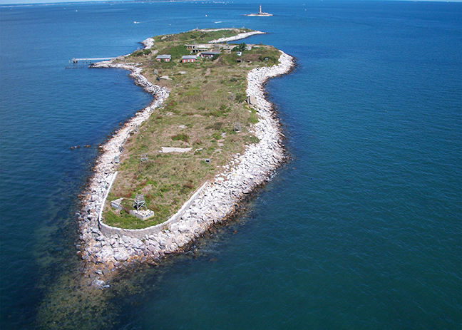
Recognizing high-resolution aerials could be used to monitor vegetation management Juliana included experiments with aerial drone flights as part of a Connecticut Sea Grant proposal. In April 2013 the official Extension/Sea Grant flights took place, fully sanctioned by the FAA (Federal Aviation Administration). Over 370 photographs were captured from a small four prop multirotor quadcopter, later processed using two different software systems, AgiSoft Photoscan and Pix4Dmapper. The result is a full high-resolution orthomosaic image of the entire island—a detailed tool for the habitat management plan. In addition the Pix4D software produced a full 3D topographic map, great potential for measuring erosion and the before and after effects of natural disasters like Superstorm Sandy.
Read more about this research project on the CLEAR website.