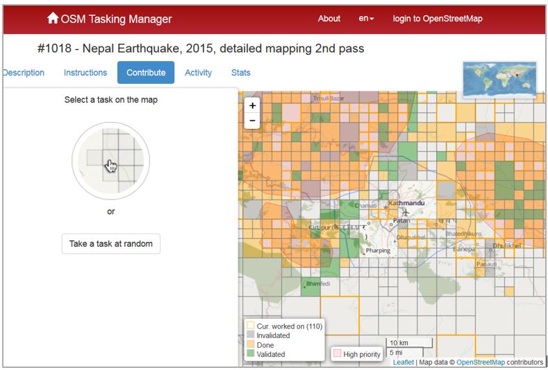
By now, you’ve heard about the devastating 7.8-magnitude earthquake that struck the country of Nepal on April 25. As of today, it has tragically claimed over 5,000 lives. Shortly after the quake, chaos and confusion engulfed the capitol city of Kathmandu. Landmark building and temples, some in world heritage sites have been destroyed and city streets in many areas are unrecognizable. But, within those first few critical hours after the earthquake, in various places around the world, people were helping. Not by proving money from their pocket but rather through a type of digital humanitarianism. Since those first few crucial hours, thousands of “digital volunteers” have logged countless hours scanning over 14,700 square kilometers worth of new high resolution satellite imagery digitizing buildings, roads, waterways and any other identifiable infrastructure. This new wave of humanitarian crowdsourced mapping is part of the Open Street Map (OSM) community, a group of global digital volunteers that update basemaps using satellite and aerial imagery supplied by Bing Maps. These volunteers mobilize quickly after natural or humanitarian disasters and help first responders on the ground by providing them with the most accurate, up-to-date maps available. Also helping the effort in Nepal is Kathmandu Living Labs which is providing on the ground local knowledge of the city and surrounding areas. This has been critical not only in the capitol city but also in many of the remote towns and villages surrounding the city where basemaps and geographic data were largely unavailable before the quake. Geographic information system (GIS) analysts are able to access these volunteer created maps to help identify safe open spaces that can be used to set up camps for displaced people and first responders can load updated maps to their smart devices in the field.
The system for adding community driven geographic content to web maps has been in place since OSM was created in 2006. OSM efforts to update maps after major disasters have been steadily improving since it introduced new tools after the 2010 earthquakes in Haiti. Essentially, a task manager splits up the geographic area into a series of grid cells and assigns a cell to a single editor at a time. This enables volunteers to work simultaneously and ensure there is no overlapping efforts. A validation system has been implemented as well, ensuring that a second review of edited data is performed before those edits are integrated into the master map. As of this hour, 3,569 OSM volunteers have made 87,436 edits to roadways and 229,714 edits to buildings in affected areas of Nepal (reference). Of those making edits, 2148 digital volunteers are new to the OSM effort since the earthquake struck. You can help too! All you need is a computer with internet access and a few free minutes of time. Follow this link to learn more and get started!
