UConn Land Use Academy Celebrates 20th Anniversary and Evolving Needs
CLEAR’s very own Renata Bertotti was featured in UConn Today’s article, UConn Land Use Academy Celebrates 20th Anniversary and Evolving Needs, discussing her work with the Land Use Academy – which is now celebrating its 20th anniversary. The Land Use Academy provides education for local land use planners as they make decisions balancing development and environmental […]
[Read More]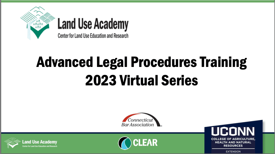
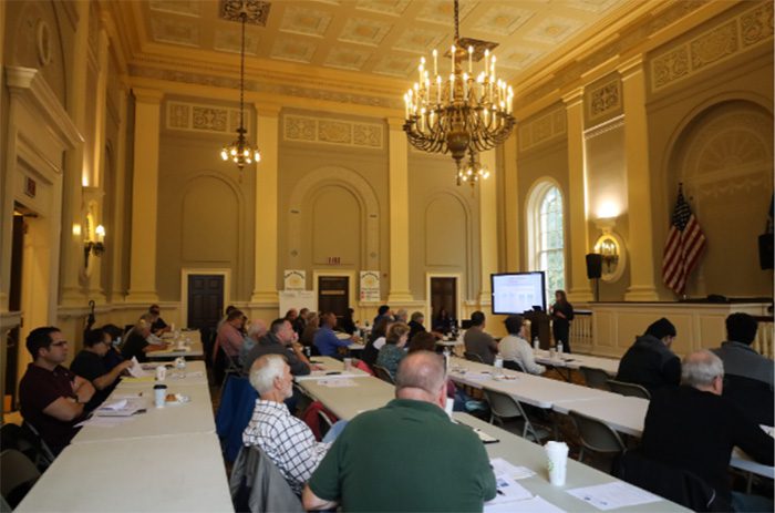
Land Use Academy Advanced Training Session Recordings
UConn CLEAR’s Land Use Academy held a series of three Advanced Legal Procedures virtual training sessions for land use commissioners in February. The sessions included (1) Bias, Conflict and Predisposition; (2) Running a Meeting and Making A Decision; and (3) Fair and Affordable Housing. The session were presented in collaboration with the CT Bar Association. […]
[Read More]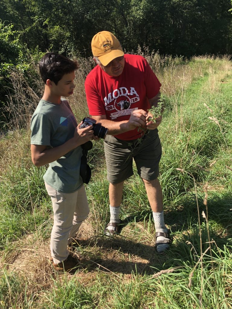
Teen-Adult Conservation Projects Contributing to Town’s Sustainable CT Efforts
Every year, UConn’s Natural Resources Conservation Academy supports ~50 teen-adult partnerships as the teams embark on a common goal: to tackle an environmental issue that is relevant to their community. These intergenerational conservation efforts span an incredible range of topics (e.g., mapping, invasive species, restoration, soils & agriculture, wildlife & fisheries, public outreach, and water […]
[Read More]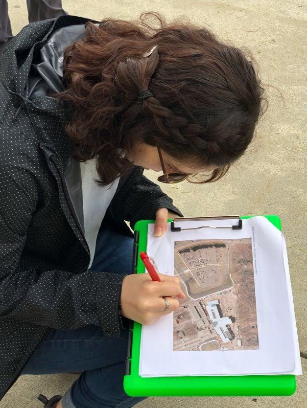
Harnessing Student Power to Find Greener Stormwater Options
If you were out and about in the towns of North Haven, Milford, Hamden, West Haven or Cheshire this summer, you may have seen a team of four young adults writing on clipboards, snapping pictures of parking lots, laying their phones down on the sidewalk, and peering down into storm drains. These four intrepid UConn […]
[Read More]New Training! Intro to ArcGIS Online & Storymaps
The CLEAR Geospatial Training Program (GTP) has just launched a brand new workshop! It is called Introduction to ArcGIS Online and Esri Story Maps and includes presentations, demos, hands-on exploration and hands-on exercises. The morning of the day-long workshop covers ArcGIS Online and the web map in particular. Topics include: Introduction to GIS and ArcGIS […]
[Read More]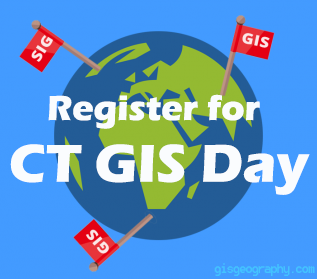
CT GIS Day is November 14 in Hartford
Next week is Geography Awareness Week and the CT GIS Network is celebrating by hosting the annual CT GIS Day on Wednesday, November 14 at the Hartford Public Library. This event is free and open to the public and will include a full day of activities including presentations from mapping professionals from across CT and […]
[Read More]
Is there any hope to fix our salt problem? Perhaps…
Another winter has finally ended, and messy roads and salty cars are quickly becoming a distant memory. Where did all that salt go? The millions of tons of deicing salts that get applied to our roads either wash off into local streams, or move into the local groundwater. Yet another research study has recently come […]
[Read More]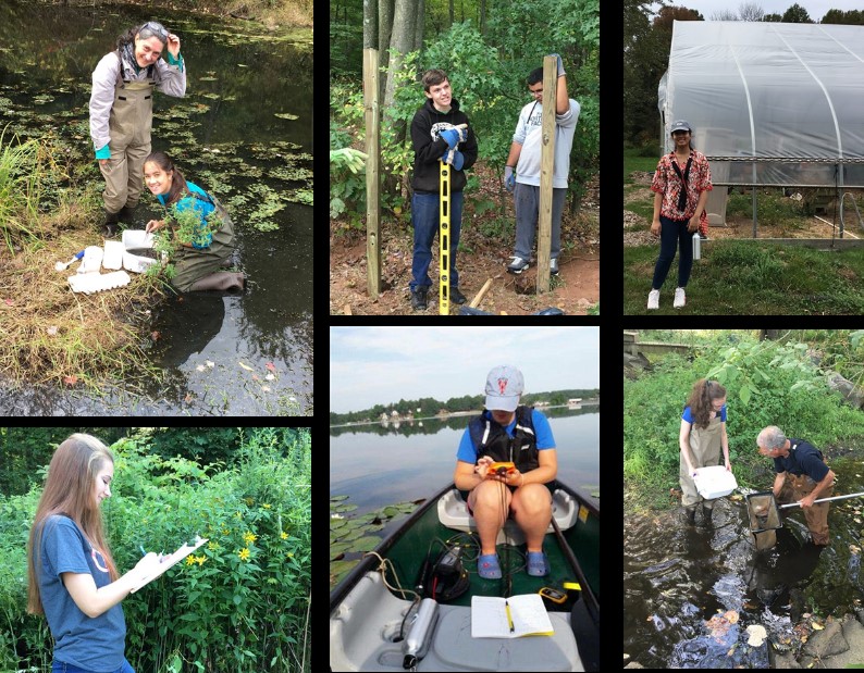
The Myth of the Lazy Teen
A friend of mine recently told me that they thought all teenagers were lazy. Raise your hand if you’ve ever thought this before. Anyone? Bueller? Don’t worry, it’s okay if you have. I won’t tell anyone. I personally think teens get a bad rap. High schools often start in the seven o’clock hour, course loads […]
[Read More]That Sound You Hear is the Hatching of Conservation Projects!
Last week saw the successful launch of the Conservation Training Partnership program, the goal of which is to develop and carry out local conservation projects around the state powered by teams of high school students and community volunteers. The CTP is an outgrowth of the Natural Resources Conservation Academy, the week-long program for high school […]
[Read More]UConn’s Natural Resources Conservation Academy Adds Two New Education Programs in 2017
Founded in 2011, the Natural Resources Conservation Academy (NRCA) is designed to provide high school students with a structured informal learning experience focused on the environment, natural resources and geospatial technologies. In case you haven’t heard about it yet, let me get you caught up. The NRCA is all about making connections. Connecting young adults […]
[Read More]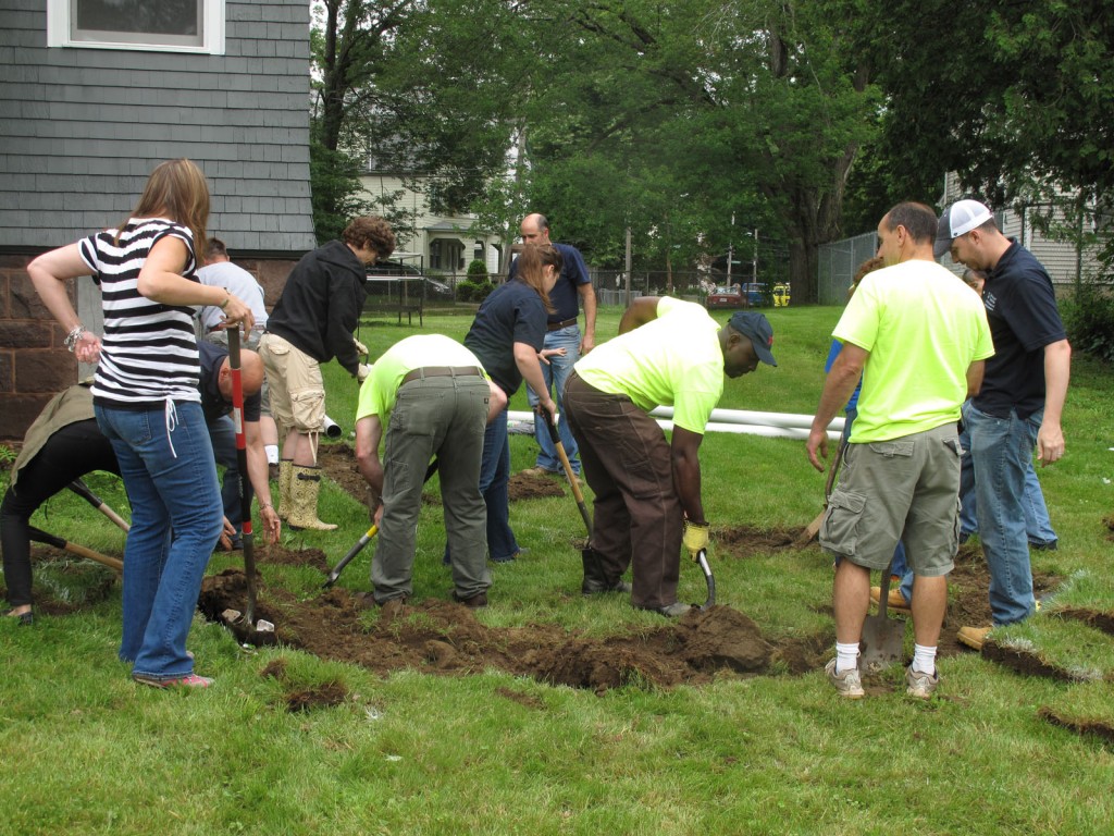
Bringing Some Green to Our Big Cities
When people think of Hartford and New Haven, “green” may not be the first thing that jumps to mind. However, recent efforts of the UConn Nonpoint Education for Municipal Officials (NEMO) program are helping to make these cities a little bit greener, both figuratively and literally. This past June, NEMO partnered with Neighborhood Housing Services […]
[Read More]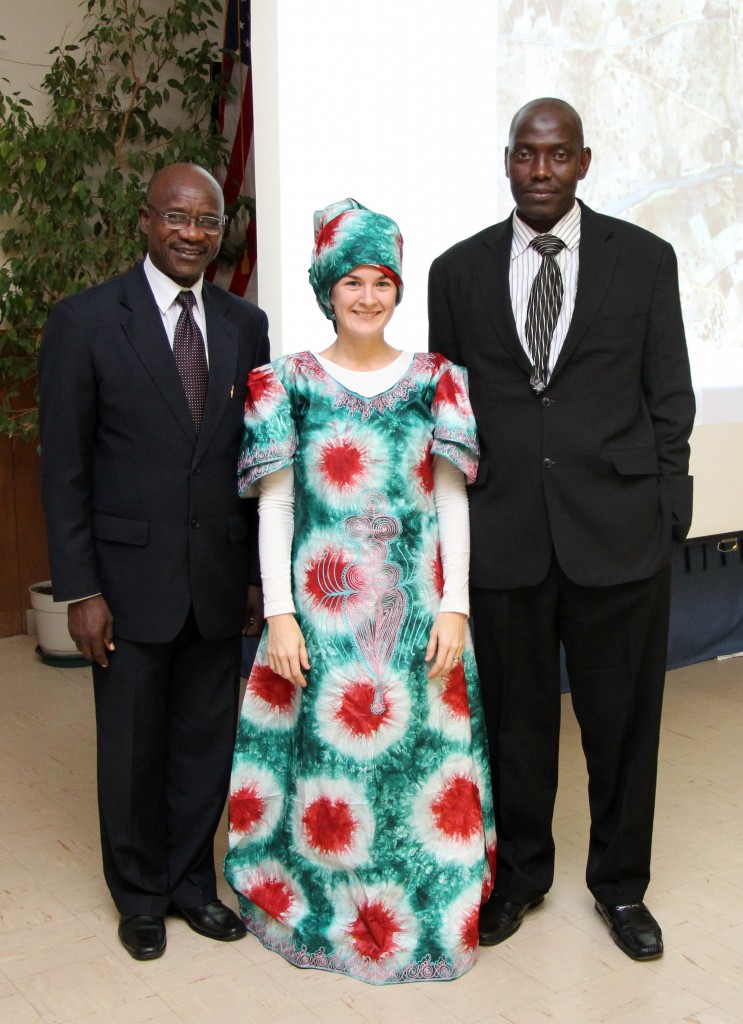
CLEAR’s Geospatial Training Program Goes Global
When an email from Dr. Yahaya Umar at the Nigerian Defence Academy came across my desk last July indicating interest in CLEAR’s hands-on workshop on Geographic Information System (GIS) technology, I was initially a bit skeptical. Why would anyone from the other side of the world want to travel all the way to UConn to […]
[Read More]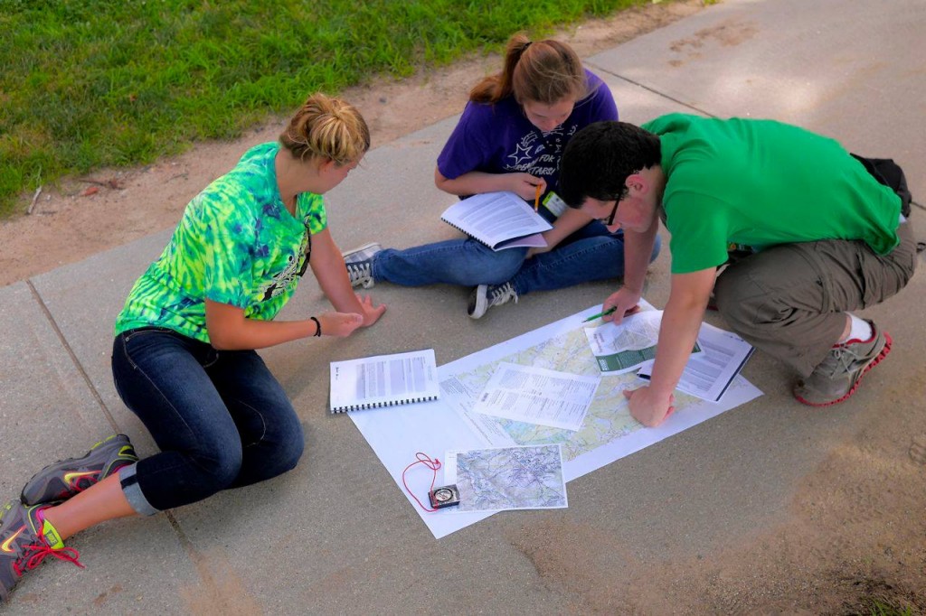
Teens Master the Art (and fun!) of Mapping at UConn’s NRC Academy
The Natural Resource Conservation Academy (NRCA) is an innovative program in conservation and land use planning for a select group of Connecticut high school students. The Academy starts with a week-long field course at the University of Connecticut in Storrs. Throughout the week, students interact with UConn faculty and learn about mapping and geospatial information, […]
[Read More]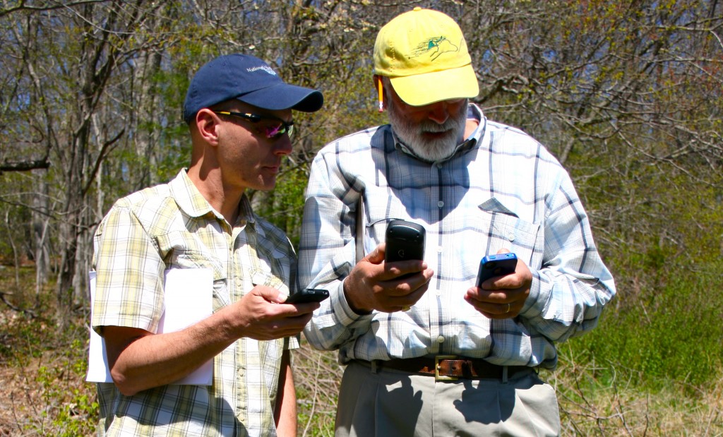
Goodbye GPS Unit, Hello Smart Phone
Smartphones are the swiss army knife of the digital world. They have replaced countless single-function gadgets from calculators to cameras to pagers to, um, phones! But for mapping geeks, one of the gadgets they have not quite been able to shake is the handheld GPS unit, at least until now. The Geospatial Training Program at […]
[Read More]This is Not Your Dog’s Clicker Training
When you say the word “clicker” the first thing many people think of is training a dog. But clickers can also refer to the devices used to engage an audience in group decision-making. When a contestant in a game show decides to “ask the audience,” an audience response system (aka clicker) is used. Recently, clickers […]
[Read More]Rain Garden App!
I’ve only had my iPhone since May 2011. It’s not that I didn’t think they were cool and useful (I had bought one for my wife a year before), I just was trying to delay joining the “in crowd” for a while longer. Now it seems like I have had it forever, and it is […]
[Read More]What the Heck is the Land Use Academy?
As a local land use commissioner you are faced with making decisions about how your community will grow, reviewing and approving applications for a variety of projects and balancing growth with natural resource protection. Sometimes court decisions change the rules, you receive conflicting advice, the information you have to work with is incomplete or you […]
[Read More]New Rain Garden "How To" Website for Homeowners
CLEAR’s NEMO program recently partnered with the Connecticut Fund for the Environment‘s Save the Sound program to create a rain garden “how to” website, focused on helping Connecticut and New England homeowners build their own rain garden. The Rain Gardens website is meant to be a companion site to both the CT NEMO website and Save […]
[Read More]CLEAR’s Newest Geospatial Technology Course Focuses on Land Trusts
CLEAR’s Geospatial Training Program (GTP) has partnered with the Connecticut Land Conservation Council to develop a new course for land trust staff and volunteers. The first workshop was held on a sunny Friday in September. The one-day course is designed to teach participants how to use a handheld GPS receiver to map property boundaries and […]
[Read More]NEMO U8 A Tentacular Success
UConn CLEAR, in partnership with the Northland NEMO program, held the 8th NEMO University (a.k.a NEMO U8) conference in Duluth, MN last month. The conference brings together outreach professionals from around the country, primarily from programs modelled after the CT NEMO program, to share innovative approaches and ideas to working with communities on land use and water […]
[Read More]