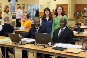
When an email from Dr. Yahaya Umar at the Nigerian Defence Academy came across my desk last July indicating interest in CLEAR’s hands-on workshop on Geographic Information System (GIS) technology, I was initially a bit skeptical. Why would anyone from the other side of the world want to travel all the way to UConn to take a three-day workshop? Surely there were other GIS training opportunities in Nigeria, or at least, on the continent of Africa. Right? And sure enough, there were. But Dr. Umar insisted that CLEAR’s training was exactly what he and his colleague, Dr. Dominic Maikaje were looking for to get them started on mapping parasitic disease outbreaks in their home state of Kaduna, Nigeria. So sure enough, after travel visas were secured and international flights were booked, Dr. Umar and Dr. Maikaje found themselves 5,200 miles from home, sitting in our classroom, shivering on a cold morning in December, introducing themselves to our other course participants and explaining how GIS was the tool they thought could transform the way their nation tracks, contains and predicts outbreaks of zoonotic (diseases transmitted from animals) disease.

Dr. Maikaje, a specialist in protozoology, and Dr. Umar, who specializes in molecular parasitology, are conducting epidemiological studies about the incidence of trypanosomiasis, a parasitic disease more commonly known as ‘sleeping sickness’ that affects both animals and humans, and liver fluke, a parasite carried by snails that live in fresh water supplies frequented by cattle and other animals. They came to the class with their research data in hand, hoping to be able to map the locations of field sample stations and identify patterns in environmental factors which might explain why different species of host snails are found in some areas and not others.
“Our goal is to gain a true picture of where the disease exists now and where it is likely to be found tomorrow. GIS can help us devise a method of containment that we hope will eventually lead to eradication of some of these diseases,” said Dr. Maikaje.
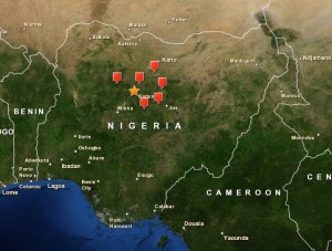
CLEAR’s Introduction to GIS training is a three day intensive, hands on training. By the end of the third day, participants are able to create their own customized maps and work with geographic data and tables to begin analyzing spatial patterns within and among the features being mapped. The map below shows the geographic distribution of six freshwater dams in Kaduna where Dr. Umar and Dr. Maikaje are conducting their research.

“CLEAR’s training was exactly what we were looking for,” said Dr. Umar. “It provided us with a fundamental understanding of what the technology can do and how we can apply it to our research. We are excited to return to Nigeria and use our new skills and continue our new collaboration with CLEAR.”
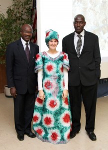
In addition to spending three days learning GIS, Dr.’s Umar and Maikaje extended their trip by a few extra days in order to work with CLEAR’s geospatial trainers, tour the UConn campus and of course, do a little sightseeing. “It was my first trip to the States, I just had to go see New York City. And wao, was it spectacular!” said Dr. Umar.
I’ll tell you what else is spectacular, Dr. Umar – your and Dr. Maikaje’s enthusiasm, determination and dedication to helping make Nigeria a safer place to live. It was a pleasure to meet you both. Everyone here at UConn is eager to see what is in store for you. There is little doubt in my mind that GIS technology can make a real difference in your country and there isn’t anyone better to head up the effort than you two. And “wao!” that sure is spectacular.
