Many of us have heard about watershed protection efforts. Perhaps you live in a drinking water supply watershed. Poor Willy Wonka was wrongly accused of poisoning the watershed of his brown river (it turned out to be chocolate). But what is a watershed, really? In physical terms, a watershed is an area of land that drains to a specified point. The size of the watershed depends upon where you put the point. For example, a tiny stream that runs near your home might have a relatively small area of land that drains to it, but the point on the Connecticut River where it meets the Long Island Sound has a very large watershed (11,300 square miles!) that extends all the way up to Canada. So we all live in a watershed, it just depends on where you put the point!
The United States Geological Survey (USGS) has a useful tool that will delineate a watershed for you. The tool is called StreamStats, and is available at http://streamstats.usgs.gov. You first select the state, and then zoom in to the location of interest. Then you select “Watershed delineation from a point”, and click any point on a stream (you need to be zoomed in fairly close to do this). The software then calculates the watershed for that point, and displays it for you. Additionally, you can get more characteristics about the watershed (such as size), or export it as a shapefile to use in GIS software.
So go ahead-pick a river near your home and try it out. You might be surprised to find how much area drains to the point you picked. This simple analysis is a critical part of any effort to help clean up or protect a water body; unless you understand what is happening on the land that drains to the river, you really don’t have a complete picture of the threats that exist. You may also notice that the watershed you delineated does not end at town boundaries. Because of this, adjacent towns may have to work together to protect or restore the resource.
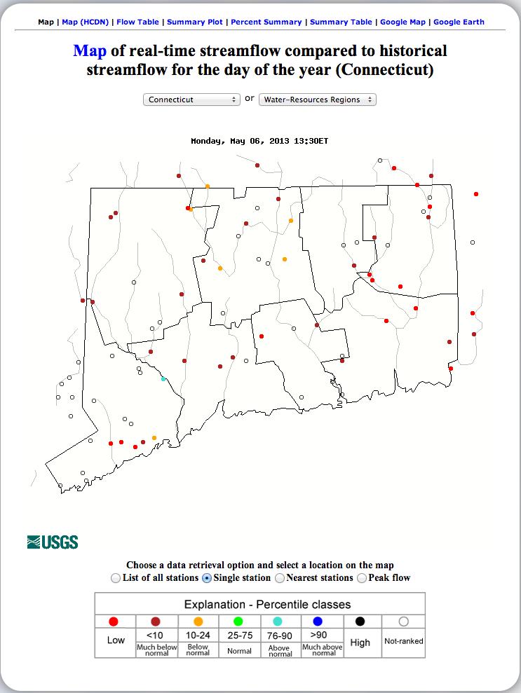
This amazing tool from USGS allows us do what was previously only possible with specialized software (and someone to operate it). While we are on the topic of USGS, they also have another great resource online where you can look at current (real-time) or historical streamflow conditions (http://waterwatch.usgs.gov). At a glance you can see national trends in streamflow (regular water only…no chocolate rivers here!), or you can zoom in to look specifically at the stations USGS operates in our state. If you have been out fishing in any of the local rivers in the past couple of weeks, this map confirms what you likely saw: we need some rain!