I am getting ready to head out on my annual backpacking trip to the Adirondacks. I love these trips, but one thing I don’t like is having to constantly pull out, unfold, and then re-fold the huge paper map for the park whenever I begin to worry I might be getting lost (which is way more frequent than it should be, but that’s another story). Being the gadget geek I am, I searched for and found a great digital alternative – Maplets.
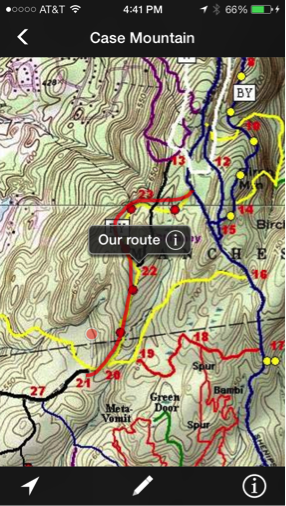
Maplets is an app for iOS (iPhone/iPad), and Android mobile devices. It provides electronic versions of the paper maps you get at parks, resorts, zoos, trail and transit systems, amusement parks, etc. that you can download to your mobile device. Once you download the map you can view and interact with it, even when you are offline (like in the middle of the Adirondacks). In addition, and this is the cool part, many of these “Maplets” are GPS enabled. That means the GPS chip in your mobile device locates you within that map and helps you navigate as you move through it. In the iOS version you can also annotate the map as you go, saving points of interest, drawing lines or paths, and making notes. Try all that with a paper map!
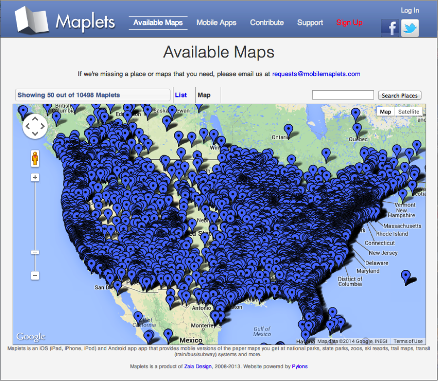
In addition to downloading interactive “paper” maps to your mobile device, you can also create your own “maplet” by uploading your paper maps to the Maplets website for others to download. This is a great option for land trusts, town recreation or open space areas, bike trails, campus maps, campgrounds, or basically any kind of map. The upload process is very simple and once complete, your maps will be available to all users of the Maplets App. There are currently over 10,000 maps available throughout the world with more being added every day. (See image below of the maps available just in the U.S.)
Sounds great, right? It is, but there are some limitations. First it costs $3 to download the app (but the maps themselves are free so you can download as many as you want). I leave it to you to decide that’s worth $3. Second, as is the case with all maps, the quality of the maplet depends on the quality of the original map. Some of the maps I have downloaded are a bit coarse/fuzzy to use for navigating.
In any case, even if you don’t download the app, might be worth a visit to their website to upload your map images to create your very own maplets. That part is free. While you are there you can also browse the maps that are available to see if it is worth forking over the dough for the app.