What's Legally Required? 8th Edition by Michael Zizka
Mike Zizka has collaborated with UConn CLEAR on the printing of his latest (8th) edition of What's Legally Required?: A guide to the legal rules for making local land use decisions in the State of Connecticut. This 273 page book is the definitive reference guide for land use planners and commissioners in the State of Connecticut. It covers:
- basic concepts in land use regulation (fundamentals, origins of land use regulation, forms of land use regulation, use of regulations)
- the scope of municipal land use authority in CT (powers & duties, substance of land use regulations)
- special issues in land use administration (FOIA, intervention, ethics, constitutional principles)
- steps in processing applications (receiving an application, exemptions, public hearing requirement)
- procedures and standards for making a decision (public hearing notice and timing, hearing procedures, making a decision, post decision notice)
- special statutory procedures and standards (affordable housing, coastal management)
- enforcement (monitoring compliance, enforcement against violations)
$35.
Proceeds from the sale of this book will be used to support Land Use Academy programs and resources.
Updates:
- The endnotes for appendix 8 can be found here. They were inadvertently left out of the book.
- Updates and Errata Sheet as of May 17, 2023.
- 2023 Legislative Update
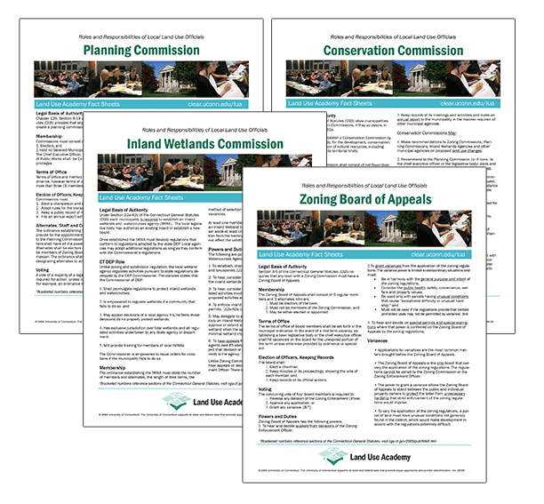
Roles and Responsibilities of Local Commissions Fact Sheets
Disclaimer: The materials contained in these fact sheets are a general, lay summary of the roles and responsibilities of local land use commissioners. They should not be relied on as a valid legal opinion or position. As such, these materials should not be used in place of consulting an attorney about the roles and responsibilities of a local land use commissioner.
Access the Roles and Responsibilities Webpage for easy access and the most updated information: https://clear.uconn.edu/roles-and-responsibilities-of-local-land-use-officials/
Last Updated: Aug. 2023
PDF copies available: Zoning | Planning | Zoning Board of Appeals | Inland Wetlands | Conservation
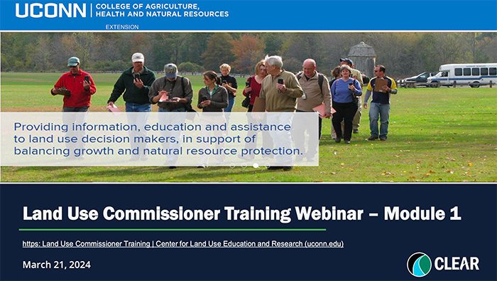
Webinars
The Land Use Academy has several webinars available for viewing. As a part of UConn CLEAR's (Center for Land Use Education and Research), the Land Use Academy contributes webinars on various topics, to the CLEAR collection. Visit CLEAR's Webinar Library for a complete list.
CLEAR Programs: Education & Training
NEMO (Nonpoint Education for Municipal Officials) provides information, education and assistance to local land use officials and other community groups on how they can accommodate growth while protecting their natural resources and community character.
The program's goal is to help municipal land use officials, staff and commission members understand and apply geospatial information technologies to help solve local land use problems and to develop environmentally sensitive land use plans. The program focuses on the use of geographic information systems (GIS), remote sensing (RS) and global positioning system (GPS) technology and online mapping and introduces new users to these technologies through hands-on training courses.
Forest Stewardship Planning provides education for natural resource professionals, elected and appointed officials, volunteers and private woodland owners who care for this valued resource and landscape. Extension educators—in cooperation with many organizational partners—seek to improve the health, care, diversity, and management of Connecticut’s trees and forests.
CLEAR Planning Tools
CT Low Impact Development (LID) Atlas
Low impact development (LID) is designed to reduce the negative impacts of traditional development on our water resources. The goal of LID is to preservation the predevelopment hydrology of a site. Site-level practices, such as rain gardens, swales, and pervious pavements, are some of the stormwater treatment practices that can be used to work towards this goal. This website allows you to retrieve LID sites from the inventory by clicking on the interactive map or selecting sites by the LID treatment practice. You can also find companies that design and install these LID practices.
Low Impact Development (LID) Regulations
There are many ways to incorporate innovative stormwater management strategies and low impact development (LID) into local town regulations. This website allows you to explore some Connecticut town and city regulations that have introduced innovative solutions to stormwater management. The list of regulations is not meant to be exhaustive. Alternatively, it is meant to help stimulate ideas on how your town can adopt lower-impact practices that protect water resources.
CLEAR Mapping Tools and Interactive Mapping
Connecticut's Changing Landscape (CCL)
Changing Landscape is a remote sensing-based land cover study that charts landscape changes in Connecticut and portions of New York. It covers the 25-year period from 1985 to 2010 (with in-between dates of 1990, 1995, 2002 and 2006). It includes information on basic land cover, as well as subsidiary analyses of riparian corridor land cover, impervious cover and agricultural field and soil analysis.
CT Environmental Conditions Online (CT ECO)
Maps & Geospatial data for everyone.